 Southeast Oahu From the Air

One part of "Virtually Hawaii" that our Team is just starting to work on is the collection of many high resolution air photographs, which will serve as a transition between the relatively low resolution satellite images and the high resolution ground photographs. These aircraft images will be collected by our business partner TerraSystems, Inc., of Kailua, Hawaii. In addition, we are also showing many of the photographs that we have taken from NASA aircraft during some of the radar and spectral measurements that were collected in 1985 and 1990.
The Virtually Hawaii Team are having great fun producing the images on this page. To show you what the work is like, here we see (from left to right) Jonathan Gradie (President of TerraSystems, Inc.) at his airborne computer console, Dick Lunn (Director of TerraSystems, Inc.) giving a helping hand to the TerraSystem plane (fondly called "Thunder Chicken"!), and Pete Mouginis-Mark (Principal Investigator for this project) directing data acquisitions on the NASA aircraft.
|
|
|
|
We hope you enjoy this small selection of pictures from the air. Come back soon, because we hope to have a whole new section showcasing these images in the near future!
|
Aerial location number 4.2: This is an oblique air photograph that gives a good view of the same area that we captured with the TerraSystems camera. In this oblique view, we're looking west into Hanauma Bay, and get good perspective of both the inner portion of the Bay and the ash layers that make up the sides of the old volcanic crater. In the background is part of the town of Hawaii Kai. |
|
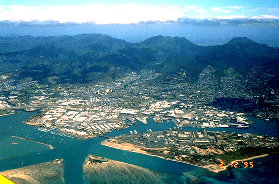
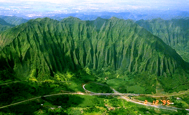
Aerial location number 5.1: This is a view looking across Kaneohe Bay, with the town of Kaneohe in the middle distance and the Koolau Range in the background. |
|
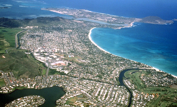
Aerial location number 5.2: Flying along the coastline of Kailua Bay one can get some wonderful views of the coral reef, and some of the excellent beaches that are wonderful for relaxing and for wind surfing! In these air photographs we can see two views of the town of Kailua. Picture 5.2 is taken from off-shore looking inland, and ... |
|
Aerial location number 5.3 is from south of Kailua looking north towards Kaneohe Marine Base in the distance. |
|
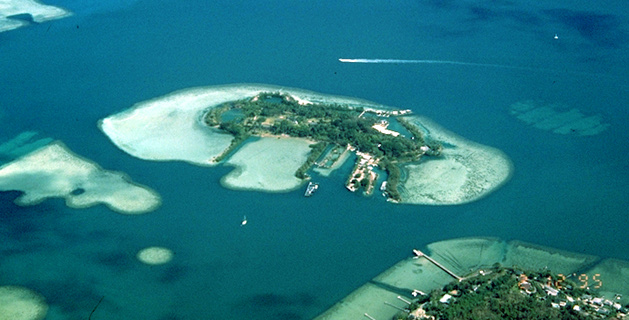
Aerial location number 5.4: This is a picture of Coconut Island, which is home to some of the University of Hawaii's marine research groups. |
|
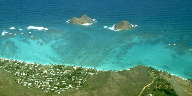
Aerial location number 5.5: This picture shows the two small Mokulua Islands that lie just off of the town of Lanikai. This area is great for swimming and wind surfing, and a favorite weekend activity of the locals is to sail (or swim!) the 1.5 km to "The Mokes" as they're fondly called. |
You have now completed the aerial tour around Southeast Oahu. If you would like, you may begin the ground tour at the beginning, or visit a specific stop on the ground tour by returning to the Southeast Oahu Virtual Field Trip Page and clicking on the corresponding white number.
You might also like to take a little quiz to test what you know about Southeast Oahu!
![]() Return to
Southeast Oahu Virtual Field Trip
Return to
Southeast Oahu Virtual Field Trip
|
Authors: Peter Mouginis-Mark & Lori Glaze
Copyright by P. Mouginis-Mark Curator: Lori Glaze Page Design: Laurence Laforga |
Copyright © 1996 All Rights Reserved. |