 Southeast Oahu Ground Tour
Stop 2: The Top of Diamond Head

The climb up Diamond Head gives the tourist a great view of Waikiki and the southern flank of the Koolau ranges. Here we see several views that are all taken from the end of the public hiking trail that takes you to the top of Diamond Head. This is about a 1-hour (one way) walk, and is a really nice hike to take -- but make sure that you take some water and a flash light with you so that you can cope with the warm temperatures in the crater, and can navigate the two short tunnels that you walk through to get to the top!
 [565x380 JPEG]
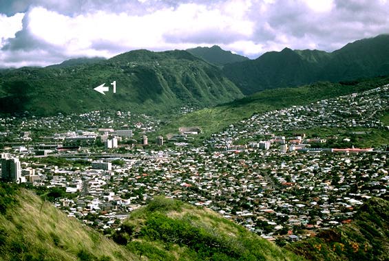
This view is the exact opposite of view #1 from Stop #1. Indeed, the location of the view point at Stop #1 is shown by the arrow. In this view, we get a better impression of the deeply eroded valley that is Manoa Valley, and the ridge crest that forms the "backbone" of the Koolau Range.
 [592x380 JPEG]
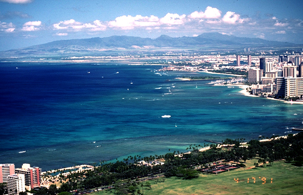
Look westward from the top of Diamond Head, one gets a view of Kapiolani Park (foreground), the many Waikiki hotels that line the coast and, on the horizon, the profile of the second (older) volcano that forms the island of Oahu. This second volcano is called the Waianae Volcano, and the highest point on the island (Mount Kaala) is seen at the northern (right hand) end of the range. Mount Kaala is over 1,300 meters (4,000 ft) high.
 [574x380 JPEG]
A telephoto camera lens shows the hotels of Waikiki in greater detail. Here we see the famous Royal Hawaiian Hotel (the pink building) surrounded by more recent hotel complexes. The Royal Hawaii has been a Hawaii landmark since the late 1920's.
 [663x330 JPEG]
Looking out to sea, but near-shore, from Diamond Head, we can see an excellent example of the coral reef that has developed around much of the island of Oahu. Here the waters are quite shallow (less than 10 meters), and provide good places to see the local fish.
 [650x325 JPEG]
Looking east from the top of Diamond Head we can see the cone of Koko Crater and the fringing coral reefs along the southern shore of Oahu. One can also see some of the great tropical vegetation that is in a part of town called Kahala.
 [396x580 JPEG]
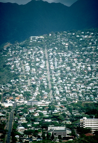
Looking towards the ridge crest of the Koolau Range (the black shadows in the background), we can see the extremes that the Oahu residents have gone to in the search of places to build their homes. St. Louis Heights is one of several ridge crests where the steep slopes have not prevented the construction of many houses.
From here you can continue on to Stop 3 on the ground.
![]() Return to
Southeast Oahu Virtual Field Trip
Return to
Southeast Oahu Virtual Field Trip
Author: Peter Mouginis-Mark
Copyright by P. Mouginis-Mark
Curator: Lori Glaze